Discussions about reducing carbon emissions from industrial emitters often tend to skip past one of the most foundational questions there is: how accurate is the emissions data?
Scientists are able to measure the overall scale of global and regional emissions, but honing in with precision on a particular high-emitting facility has proven to be surprisingly challenging. Regulators are often reliant on self-reporting or on-site inspections, providing them with nothing more than a rough approximation. Companies themselves depend on expensive monitoring techniques subject to weather and other variables, making it difficult to plan out an effective emissions reduction plan.
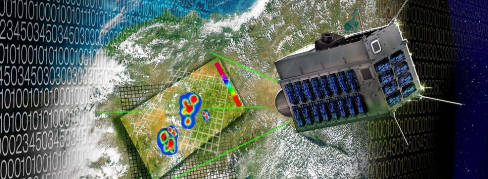
Montreal-based GHGSat has proposed one potential solution: taking to the sky. Started in 2011 with seed funding from Sustainable Development Technology Canada, Montreal-based GHGSat uses microsatellites bristling with sensors to monitor emissions at the facility level. The company’s first satellite, a microwave-sized device named Claire, is able to accurately monitor up to 1,000 facilities a year for their carbon dioxide and methane emissions using telescopic lenses and tools that measure infrared light.
Since its first satellite was launched in 2016, GHGSat has monitored over 2,000 sites including oil and gas facilities, power stations, landfills and animal feedlots, among other sources. High-profile initiatives have included an ongoing pilot project funded by the Canadian Oil Sands Innovation Alliance, Emissions Reduction Alberta, Encana and other others in Alberta to measure emissions above two tailings ponds and one mine face. GHGSat estimates that satellite monitoring can ultimately reduce operating costs by more than 50% for oil sands operators, all while offering 12 times more measurements every year.
GHGSat plans a constellation of 12 satellites by 2021, to monitor greenhouse gas emissions.
The value proposition is simple – companies are able to monitor emissions at specific facilities with greater accuracy and regularity, as well as reduce any safety risks involved in on-the-ground measurement. GHGSat also believes its technology offers substantial savings for companies, particularly at more remote facilities. For regulators and other interested parties, it can help fill in gaps in pollution monitoring, identify industry laggards, establish more accurate regulatory baselines and improve public confidence in reported data.
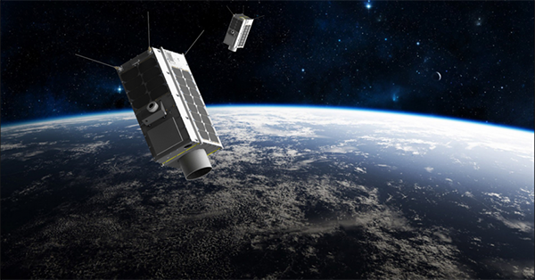
Backed by a team that has grown to 23 employees, GHGSat is now gearing up for the launch of its second satellite, Iris, in August. The new satellite will allow the company to monitor even more sites with greater frequency, providing companies with more granular data so they can better tackle methane and carbon emissions. A third satellite is being built for 2020, with the potential for another 10+ launches from GHGSat over the next five years.
With over a dozen public and private entities now racing to launch emissions-monitoring satellites in the coming years, GHGSat is confident that its early mover advantage and unique technology will place it at the forefront of this emerging industry.